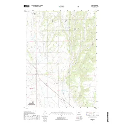
2017 Map of Pedro
USGS Topo · Published 2017About this map
Thunder Basin National Grassland encompasses this high plains landscape of Weston County, where the settlement of Pedro sits along the southern rail line. The terrain is defined by deep draws and canyons, including Blacktail Canyon and Crane Canyon, which channel seasonal water toward the drainage of Skull Cr. Small-scale water management is evident through features like the Y T Reservoir and Bernard Howell Reservoir, essential markers of ranching history in this arid environment.
Find a feature on this map
29 named features on this map. Tap any name to fly to it.
Don’t see what you’re looking for? This feature index may not catch every label — zoom into the map to look around manually.
Map Details
Editions of this 2017 Pedro Map
This is the sole edition of this map. No revisions or reprints were ever made.
Other maps of this area

1898 · Sundance
USGS Topo · 1:125,000

1899 · Newcastle
USGS Topo · 1:125,000

1901 · Newcastle
USGS Topo · 1:125,000

1902 · Sundance
USGS Topo · 1:125,000

1951 · Newcastle
USGS Topo · 1:24,000

1951 · Osage SE
USGS Topo · 1:24,000

1954 · Gillette
USGS Topo · 1:250,000

1955 · Newcastle
USGS Topo · 1:250,000

1955 · Gillette
USGS Topo · 1:250,000

1958 · Gillette
USGS Topo · 1:250,000