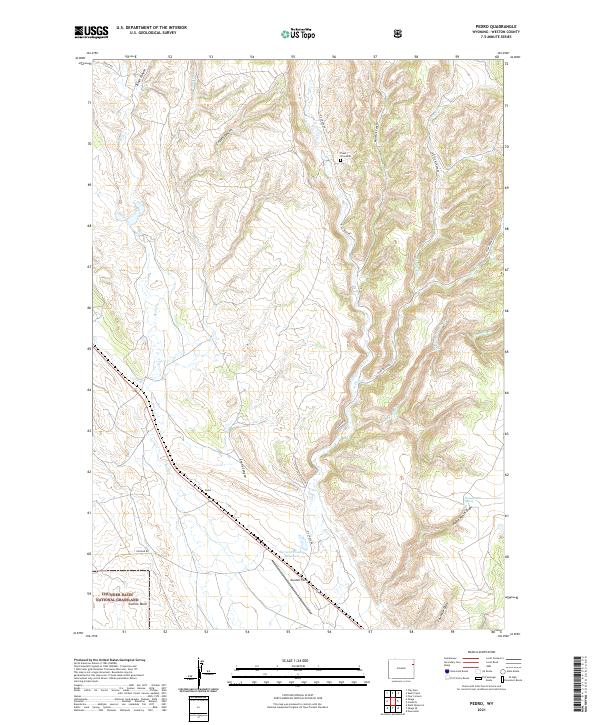
2021 Map of Pedro
USGS Topo · Published 2021About this map
Pedro sits at the heart of this Weston County landscape, where the drainage systems of Skull Cr and Oil Cr carve through the high plains. The area is defined by its ranching and grazing heritage, much of it preserved within the Thunder Basin National Grassland. A network of canyons and draws, including Coyote Canyon and Crane Canyon, breaks the terrain, while reliable water sources like Home Ranch Spring and the Bernard Howell Reservoir provide the necessary infrastructure for life in this arid environment. The map records localized history through landmarks like the Freel Gravesite, a singular point of personal history in the wide drainage of Sixmile Basin. Near the southern edge, Mondell Field serves as a modern landing strip, marking the intersection of traditional land use and contemporary transportation in this pocket of eastern Wyoming.
Find a feature on this map
29 named features on this map. Tap any name to fly to it.
Don’t see what you’re looking for? This feature index may not catch every label — zoom into the map to look around manually.
Map Details
Editions of this 2021 Pedro Map
This is the sole edition of this map. No revisions or reprints were ever made.
Other maps of this area

1898 · Sundance
USGS Topo · 1:125,000

1899 · Newcastle
USGS Topo · 1:125,000

1901 · Newcastle
USGS Topo · 1:125,000

1902 · Sundance
USGS Topo · 1:125,000

1951 · Newcastle
USGS Topo · 1:24,000

1951 · Osage SE
USGS Topo · 1:24,000

1954 · Gillette
USGS Topo · 1:250,000

1955 · Newcastle
USGS Topo · 1:250,000

1955 · Gillette
USGS Topo · 1:250,000

1958 · Gillette
USGS Topo · 1:250,000