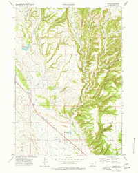
1972 Map of Pedro
USGS Topo · Published 1977About this map
Industrial activity and water management define this Wyoming landscape as it appeared in the early 1970s. The southern portion of the map is anchored by the Pedro Oil Field and Mondell Field, signaling the importance of energy extraction in Weston County. The Burlington Northern railroad cuts a diagonal path through the terrain, passing near the small settlement of Pedro, which sits at the junction of the rails and several ranch roads. To the east, a Strip Mine and Radio Facility highlight the varied uses of the land during this era.
Find a feature on this map
26 named features on this map. Tap any name to fly to it.
Don’t see what you’re looking for? This feature index may not catch every label — zoom into the map to look around manually.
Map Details
Editions of this 1972 Pedro Map
This is the sole edition of this map. No revisions or reprints were ever made.
Other maps of this area

1898 · Sundance
USGS Topo · 1:125,000

1899 · Newcastle
USGS Topo · 1:125,000

1901 · Newcastle
USGS Topo · 1:125,000

1902 · Sundance
USGS Topo · 1:125,000

1951 · Newcastle
USGS Topo · 1:24,000

1951 · Osage SE
USGS Topo · 1:24,000

1954 · Gillette
USGS Topo · 1:250,000

1955 · Newcastle
USGS Topo · 1:250,000

1955 · Gillette
USGS Topo · 1:250,000

1958 · Gillette
USGS Topo · 1:250,000