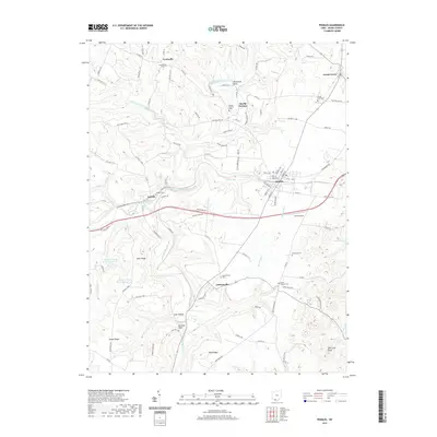
2019 Map of Peebles
USGS Topo · Published 2019About this map
Peebles serves as the central hub of this Adams County landscape, situated where the terrain transitions toward the winding course of Ohio Brush Creek. The map documents a predominantly rural and agricultural region defined by a network of small, scattered settlements like Louisville, Lawshe, and Jacksonville. The presence of numerous family and community burial grounds, including the Locust Grove Cem and Steam Furnace Cem, indicates a deeply rooted local history linked to early industry and pioneer settlement. To the southeast, the topography becomes more pronounced, rising to heights such as Deer Lick Knob, while the intricate drainages of Shimer Run and Plum Run carve through the countryside. Near the town of Marble Furnace, names like Horseshoe Bend and Polk Hollow further illustrate a landscape shaped by both water and wood, long before modern developments reached this portion of Ohio.
Find a feature on this map
110 named features on this map. Tap any name to fly to it.
Don’t see what you’re looking for? This feature index may not catch every label — zoom into the map to look around manually.
Map Details
Editions of this 2019 Peebles Map
This is the sole edition of this map. No revisions or reprints were ever made.
Other maps of this area

1915 · Bainbridge
USGS Topo · 1:48,000

1916 · Peebles
USGS Topo · 1:62,500

1917 · Bainbridge
USGS Topo · 1:62,500

1917 · Hillsboro
USGS Topo · 1:62,500

1918 · Peebles
USGS Topo · 1:62,500

1918 · Seaman
USGS Topo · 1:62,500

1944 · Hillsboro
USGS Topo · 1:62,500

1947 · Columbus
USGS Topo · 1:250,000

1957 · Huntington
USGS Topo · 1:250,000

1960 · Huntington
USGS Topo · 1:250,000