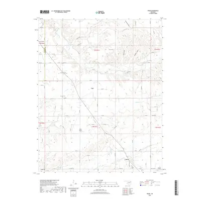
2019 Map of Peggs
USGS Topo · Published 2019About this map
Peggs and Gideon anchor this rural landscape in the Cherokee Ozarks, where the drainage patterns of Spring Cr and Fourteenmile Cr have carved a complex network of hollows. The terrain is defined by named depressions like Davis Hollow, Blacksmith Hollow, and Yokum Hollow, which dictate the winding paths of local section-line roads. This 2019 survey documents a landscape where traditional small-town Oklahoma settlements coexist with modern aviation, as evidenced by the Flying J Ranch Airport and John Reid Airport.
Find a feature on this map
64 named features on this map. Tap any name to fly to it.
Don’t see what you’re looking for? This feature index may not catch every label — zoom into the map to look around manually.
Map Details
Editions of this 2019 Peggs Map
This is the sole edition of this map. No revisions or reprints were ever made.
Other maps of this area

1896 · Pryor
USGS Topo · 1:125,000

1898 · Tahlequah
USGS Topo · 1:125,000

1899 · Siloam Springs
USGS Topo · 1:125,000

1901 · Muscogee
USGS Topo · 1:125,000

1901 · Pryor
USGS Topo · 1:125,000

1901 · Tahlequah
USGS Topo · 1:125,000

1903 · Siloam Springs
USGS Topo · 1:125,000

1904 · Siloam Springs
USGS Topo · 1:125,000

1905 · Muscogee
USGS Topo · 1:125,000

1905 · Tahlequah
USGS Topo · 1:125,000