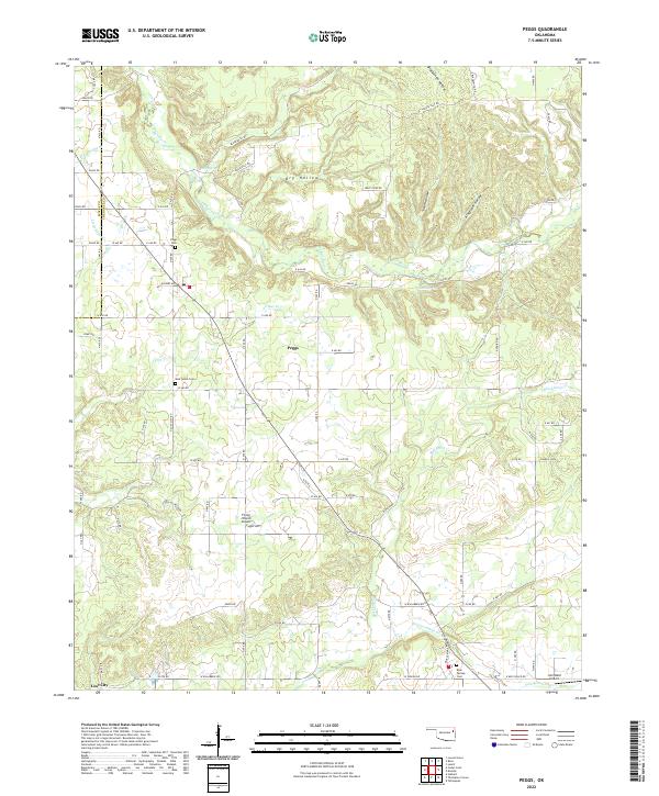
2022 Map of Peggs
USGS Topo · Published 2022About this map
Peggs serves as the primary hub for this portion of northeastern Oklahoma, situated where the wooded hills of the Ozark Plateau transition into a network of creek-carved hollows. The landscape is defined by the convergence of several major watercourses, including Spring Creek and Fourteenmile Cr, which have historically shaped the settlement patterns and road networks of the area. Local family history is preserved in several burial grounds, such as Peggs Cem, New Home Cem, and Blue Springs Cem, reflecting the deep-rooted community ties of this region. The terrain is marked by distinctive geological features like Dry Hollow and Blacksmith Hollow, while modern utility is represented by the Flying J Ranch Airport and the John Reid Airport. This map illustrates a rural landscape where section-line roads, such as Hickory Ave and W 640 Rd, navigate around the winding drainage basins of Blackbird Creek and Little Clear Creek.
Find a feature on this map
74 named features on this map. Tap any name to fly to it.
Don’t see what you’re looking for? This feature index may not catch every label — zoom into the map to look around manually.
Map Details
Editions of this 2022 Peggs Map
This is the sole edition of this map. No revisions or reprints were ever made.
Other maps of this area

1896 · Pryor
USGS Topo · 1:125,000

1898 · Tahlequah
USGS Topo · 1:125,000

1899 · Siloam Springs
USGS Topo · 1:125,000

1901 · Muscogee
USGS Topo · 1:125,000

1901 · Pryor
USGS Topo · 1:125,000

1901 · Tahlequah
USGS Topo · 1:125,000

1903 · Siloam Springs
USGS Topo · 1:125,000

1904 · Siloam Springs
USGS Topo · 1:125,000

1905 · Muscogee
USGS Topo · 1:125,000

1905 · Tahlequah
USGS Topo · 1:125,000