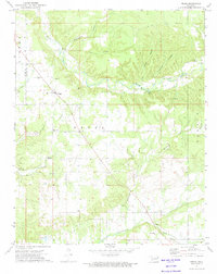
1972 Map of Peggs
USGS Topo · Published 1974About this map
The community of Peggs sits at a geographic crossroads in the early 1970s, positioned where the terrain transitions toward the rugged drainage of Spring Creek. This area of Cherokee County is defined by its numerous small congregations and water sources, including New Home Ch and Baptist Ch, which served the local farming population. The map reveals a landscape deeply carved by water, with a network of named hollows like Blacksmith Hollow and Yokum Hollow feeding into the larger creek systems.
Find a feature on this map
27 named features on this map. Tap any name to fly to it.
Don’t see what you’re looking for? This feature index may not catch every label — zoom into the map to look around manually.
Map Details
Editions of this 1972 Peggs Map
This is the sole edition of this map. No revisions or reprints were ever made.
Other maps of this area

1896 · Pryor
USGS Topo · 1:125,000

1898 · Tahlequah
USGS Topo · 1:125,000

1899 · Siloam Springs
USGS Topo · 1:125,000

1901 · Muscogee
USGS Topo · 1:125,000

1901 · Pryor
USGS Topo · 1:125,000

1901 · Tahlequah
USGS Topo · 1:125,000

1903 · Siloam Springs
USGS Topo · 1:125,000

1904 · Siloam Springs
USGS Topo · 1:125,000

1905 · Muscogee
USGS Topo · 1:125,000

1905 · Tahlequah
USGS Topo · 1:125,000