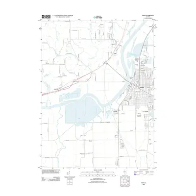
2012 Map of Pekin
USGS Topo · Published 2012About this map
The Illinois River dictates the landscape of this region, separating the industrial and residential grid of Pekin from the smaller settlements and wetlands to the west. On the eastern bank, the city's growth is marked by a dense concentration of civic and religious sites, including Sacred Heart Catholic Cem, Lakeside Cem, and Saint Joseph's Catholic Cem. These established grounds sit adjacent to the backwaters of Pekin Lake and Worley Lake, highlighting the historic tension between urban development and the river's floodplain.
Find a feature on this map
154 named features on this map. Tap any name to fly to it.
Don’t see what you’re looking for? This feature index may not catch every label — zoom into the map to look around manually.
Map Details
Editions of this 2012 Pekin Map
This is the sole edition of this map. No revisions or reprints were ever made.
Other maps of this area

1905 · Peoria
USGS Topo · 1:62,500

1927 · Peoria
USGS Topo · 1:62,500

1929 · Manito
USGS Topo · 1:62,500

1930 · Glasford
USGS Topo · 1:62,500

1932 · Manito
USGS Topo · 1:62,500

1942 · Delavan
USGS Topo · 1:62,500

1948 · Glasford
USGS Topo · 1:62,500

1949 · Peoria East
USGS Topo · 1:24,000

1949 · Peoria West
USGS Topo · 1:24,000

1950 · Peoria West
USGS Topo · 1:24,000