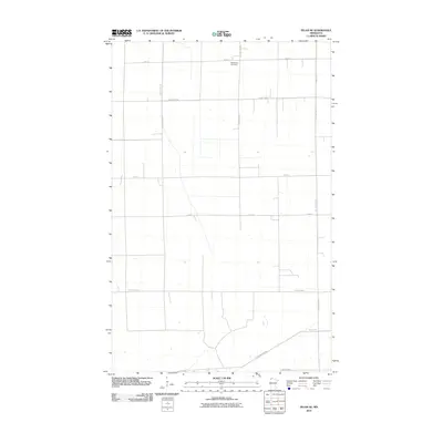
2010 Map of Pelan SE
USGS Topo · Published 2010About this map
Bethlehem Cemetery serves as a primary landmark in this rural landscape of Roseau County, where the topography is defined by a precise grid of agricultural transport routes. Mapping by the U.S. Geological Survey reveals a network of county highways including County Hwy-23, County Hwy-107, and County Hwy-8, which facilitate movement through the expansive fields of northern Minnesota. The spatial organization of the region is evident through the intersection of long thoroughfares like 150th St and 120th St. In the southern portion of the quadrangle, East Park Dr NW and 430th St NW reflect the continued importance of well-maintained local roads in connecting isolated farmsteads and rural sites during the early 21st century.
Find a feature on this map
14 named features on this map. Tap any name to fly to it.
Don’t see what you’re looking for? This feature index may not catch every label — zoom into the map to look around manually.
Map Details
Editions of this 2010 Pelan SE Map
This is the sole edition of this map. No revisions or reprints were ever made.
Other maps of this area

1918 · Greenbush
USGS Topo · 1:62,500

1918 · Middle River
USGS Topo · 1:62,500

1919 · Pelan
USGS Topo · 1:62,500

1952 · Thief River Falls
USGS Topo · 1:250,000

1956 · Thief River Falls
USGS Topo · 1:250,000

1957 · Thief River Falls
USGS Topo · 1:250,000

1957 · Newfolden
USGS Topo · 1:62,500

1957 · Pelan
USGS Topo · 1:62,500

1962 · Strathcona
USGS Topo · 1:24,000
1962 · Middle River
USGS Topo · 1:24,000