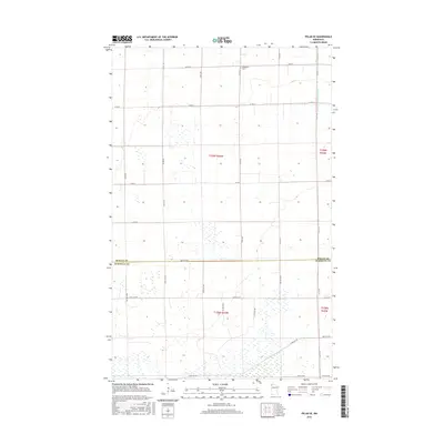
2016 Map of Pelan SE
USGS Topo · Published 2016About this map
The flat, wetland-dominated landscape of northwestern Minnesota defines this area along the border of Roseau Co and Marshall Co. The land is heavily marked by extensive drainage infrastructure, most notably the long, straight runs of Lateral Ditch Number Nine and Judicial Ditch Number Nineteen. These engineering works, along with a rigid grid of section roads like Co Rd 8 and 150th St, reflect the systematic effort to manage the high water table for agricultural use. The Bethlehem Cem stands as a quiet marker of local history, situated near Co Rd 23 in the northern portion of the quadrangle. Most of the terrain is a mosaic of saturated fields and small ponds, illustrating the challenging nature of the Red River Valley’s eastern edge.
Find a feature on this map
34 named features on this map. Tap any name to fly to it.
Don’t see what you’re looking for? This feature index may not catch every label — zoom into the map to look around manually.
Map Details
Editions of this 2016 Pelan SE Map
This is the sole edition of this map. No revisions or reprints were ever made.
Other maps of this area

1918 · Greenbush
USGS Topo · 1:62,500

1918 · Middle River
USGS Topo · 1:62,500

1919 · Pelan
USGS Topo · 1:62,500

1952 · Thief River Falls
USGS Topo · 1:250,000

1956 · Thief River Falls
USGS Topo · 1:250,000

1957 · Thief River Falls
USGS Topo · 1:250,000

1957 · Newfolden
USGS Topo · 1:62,500

1957 · Pelan
USGS Topo · 1:62,500

1962 · Strathcona
USGS Topo · 1:24,000
1962 · Middle River
USGS Topo · 1:24,000