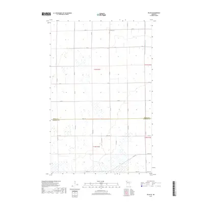
2019 Map of Pelan SE
USGS Topo · Published 2019About this map
The flat, sectioned borderlands of northern Minnesota are defined by an extensive drainage network and a rigid grid of rural roads. This landscape, straddling the boundary between Roseau and Marshall counties, is primarily managed through man-made waterways like Lateral Ditch Number Nine and Judicial Ditch Number Nineteen, which signify the region's agricultural adaptation. The Bethlehem Cem stands as a solitary point of genealogical interest in the northern portion of the map, located near 150th ST. Movement through this sparsely settled area relies on established corridors such as Co Rd 8 and Co Hwy 27, which navigate the various wetlands and township divisions of t159n r44w and t158n r44w.
Find a feature on this map
20 named features on this map. Tap any name to fly to it.
Don’t see what you’re looking for? This feature index may not catch every label — zoom into the map to look around manually.
Map Details
Editions of this 2019 Pelan SE Map
This is the sole edition of this map. No revisions or reprints were ever made.
Other maps of this area

1918 · Greenbush
USGS Topo · 1:62,500

1918 · Middle River
USGS Topo · 1:62,500

1919 · Pelan
USGS Topo · 1:62,500

1952 · Thief River Falls
USGS Topo · 1:250,000

1956 · Thief River Falls
USGS Topo · 1:250,000

1957 · Thief River Falls
USGS Topo · 1:250,000

1957 · Newfolden
USGS Topo · 1:62,500

1957 · Pelan
USGS Topo · 1:62,500

1962 · Strathcona
USGS Topo · 1:24,000
1962 · Middle River
USGS Topo · 1:24,000