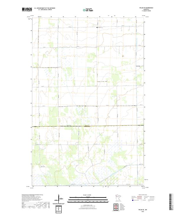
2022 Map of Pelan SE
USGS Topo · Published 2022About this map
The Bethlehem Cem sits near the northern boundary of this agricultural landscape along 150th St, serving as a primary point of interest for genealogists tracing families in the Pelan area. The map illustrates a highly managed water system essential for the region's farming economy, characterized by the prominent Lateral Ditch Number Nine in the northeast and Judicial Ditch Number Nineteen cutting across the southern sections. These artificial waterways highlight the massive 20th-century drainage efforts required to utilize the low-lying prairie land. The border between Roseau and Marshall counties bisects the sheet, following the straight line of 460th St NW. The landscape is further defined by a rigid grid of rural roads like Co Rd 8 and Co Rd 23, which provide access to the remote township sections of T159N R44W and T158N R44W.
Find a feature on this map
35 named features on this map. Tap any name to fly to it.
Don’t see what you’re looking for? This feature index may not catch every label — zoom into the map to look around manually.
Map Details
Editions of this 2022 Pelan SE Map
This is the sole edition of this map. No revisions or reprints were ever made.
Other maps of this area

1918 · Greenbush
USGS Topo · 1:62,500

1918 · Middle River
USGS Topo · 1:62,500

1919 · Pelan
USGS Topo · 1:62,500

1952 · Thief River Falls
USGS Topo · 1:250,000

1956 · Thief River Falls
USGS Topo · 1:250,000

1957 · Thief River Falls
USGS Topo · 1:250,000

1957 · Newfolden
USGS Topo · 1:62,500

1957 · Pelan
USGS Topo · 1:62,500

1962 · Strathcona
USGS Topo · 1:24,000
1962 · Middle River
USGS Topo · 1:24,000