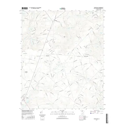
2017 Map of Pelion East
USGS Topo · Published 2017About this map
Pelion and the surrounding Lexington County landscape are defined by an intricate network of small ponds and the headwaters of the Bull Swamp Creek system. The area exhibits a pattern of rural crossroads and named settlements such as Edmund, Macedon, and Testo, connected by roads like Boiling Springs Rd and Old Orangeburg Rd. The settlement at Sharpes Hill sits among a cluster of water features, including Sharpes Pond, Hollow Pond, and Goodwin Pond. Local history is anchored by numerous family and community landmarks, from the Antioch Church and Antioch Cem to the Reichter-Richter Cem. Aviation is central to the local geography, with the Lexington County Airport at Pelion and the smaller Darden Airport serving as prominent landmarks alongside the path of the Railroad Ave corridor through Pelion.
Find a feature on this map
165 named features on this map. Tap any name to fly to it.
Don’t see what you’re looking for? This feature index may not catch every label — zoom into the map to look around manually.
Map Details
Editions of this 2017 Pelion East Map
This is the sole edition of this map. No revisions or reprints were ever made.
Other maps of this area

1944 · Gilbert
USGS Topo · 1:62,500

1944 · Seivern
USGS Topo · 1:62,500

1944 · Edmund
USGS Topo · 1:62,500

1946 · Woodford
USGS Topo · 1:62,500

1954 · Augusta
USGS Topo · 1:250,000

1957 · Augusta
USGS Topo · 1:250,000

1958 · Augusta
USGS Topo · 1:250,000

1961 · Augusta
USGS Topo · 1:250,000

1962 · Augusta
USGS Topo · 1:250,000
1972 · Lexington
USGS Topo · 1:24,000