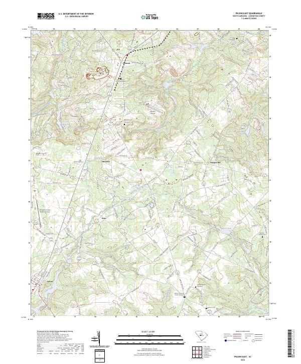
2024 Map of Pelion East
USGS Topo · Published 2024About this map
Pelion and Edmund anchor this portrait of Lexington County, where the landscape is defined by the drainage systems of Cedar Creek, Bull Swamp Creek, and Scouter Branch. This area of South Carolina is notable for its numerous family and church burial grounds, providing a significant resource for genealogical research. Features such as the Mount Hebron Church Graveyard, Bethel Church Graveyard, and Bachman Cem are documented alongside smaller sites like the Reichter - Richter Cem. Aviation infrastructure is prominent with both Darden Airport and the Lexington County Airport at Pelion serving the region. The map also shows a dense network of local ponds including Guignard Pond, Feigles Pond, and Schumpert Pond, reflecting the importance of water management in this part of the state. Settlement patterns remain clustered around rural junctions such as Macedon, Testo, and Sharpes Hill, linked by a web of local routes like Old Charleston Rd.
Find a feature on this map
172 named features on this map. Tap any name to fly to it.
Don’t see what you’re looking for? This feature index may not catch every label — zoom into the map to look around manually.
Map Details
Editions of this 2024 Pelion East Map
This is the sole edition of this map. No revisions or reprints were ever made.
Other maps of this area

1944 · Gilbert
USGS Topo · 1:62,500

1944 · Seivern
USGS Topo · 1:62,500

1944 · Edmund
USGS Topo · 1:62,500

1946 · Woodford
USGS Topo · 1:62,500

1954 · Augusta
USGS Topo · 1:250,000

1957 · Augusta
USGS Topo · 1:250,000

1958 · Augusta
USGS Topo · 1:250,000

1961 · Augusta
USGS Topo · 1:250,000

1962 · Augusta
USGS Topo · 1:250,000
1972 · Lexington
USGS Topo · 1:24,000