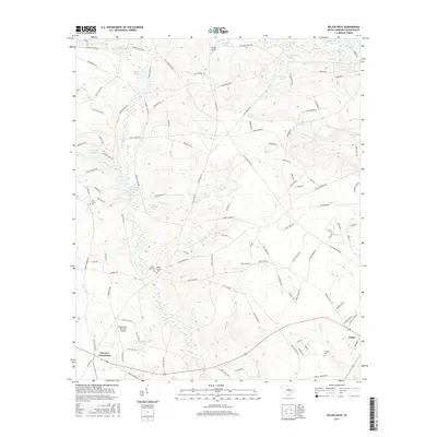
2017 Map of Pelion West
USGS Topo · Published 2017About this map
Fairview Crossroads and the western outskirts of Pelion define this Lexington County landscape, where the headwaters of numerous creeks begin their descent through the sandy Midlands. The area is characterized by an intricate network of small water bodies and historical impoundments, including Smiths Millpond, Paxton Millpond, and Clarks Millpond. These ponds reflect a legacy of local milling and water management along the tributaries of Black Cr and Boiling Springs Cr.
Find a feature on this map
123 named features on this map. Tap any name to fly to it.
Don’t see what you’re looking for? This feature index may not catch every label — zoom into the map to look around manually.
Map Details
Editions of this 2017 Pelion West Map
This is the sole edition of this map. No revisions or reprints were ever made.
Other maps of this area

1944 · Gilbert
USGS Topo · 1:62,500

1944 · Seivern
USGS Topo · 1:62,500

1944 · Edmund
USGS Topo · 1:62,500

1946 · Woodford
USGS Topo · 1:62,500

1954 · Augusta
USGS Topo · 1:250,000

1957 · Augusta
USGS Topo · 1:250,000

1958 · Augusta
USGS Topo · 1:250,000

1961 · Augusta
USGS Topo · 1:250,000

1962 · Augusta
USGS Topo · 1:250,000
1972 · Lexington
USGS Topo · 1:24,000