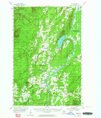
1954 Map of Pelkie
USGS Topo · Published 1964About this map
The Sturgeon River and Otter River wind through the heart of the Copper Country in this mid-century survey of the boundary between Houghton and Baraga counties. The Finnish heritage of the region is evident in the cluster of small farming communities and rural landmarks, including the settlements of Pelkie, Tapiola, and Elo. The landscape is dominated by the sprawling timberlands of the Baraga State Forest and Ottawa National Forest, punctuated by the distinct elevation of Limestone Mountain and several small rural cemeteries like Askel Cem and Kani Cem. Transportation in the 1950s relied on the Duluth South Shore and Atlantic Railroad, which cuts through the southern terrain toward the village of Baraga. This map documents a period of transition for these remote northern Michigan outposts, recording the exact locations of country schoolhouses like Tapiola Sch and neighborhood churches like Kyro Ch before later consolidation.
Find a feature on this map
54 named features on this map. Tap any name to fly to it.
Don’t see what you’re looking for? This feature index may not catch every label — zoom into the map to look around manually.
Map Details
Editions of this 1954 Pelkie Map
Other maps of this area

1915 · Houghton
USGS Topo · 1:62,500

1946 · Chassell
USGS Topo · 1:24,000

1946 · South Range
USGS Topo · 1:24,000

1948 · South Range
USGS Topo · 1:24,000

1948 · Chassell
USGS Topo · 1:24,000

1954 · Graveraet River
USGS Topo · 1:24,000

1954 · Rousseau
USGS Topo · 1:62,500

1954 · Keweenaw Bay
USGS Topo · 1:62,500

1954 · Point Mills
USGS Topo · 1:24,000

1954 · Pelkie
USGS Topo · 1:62,500