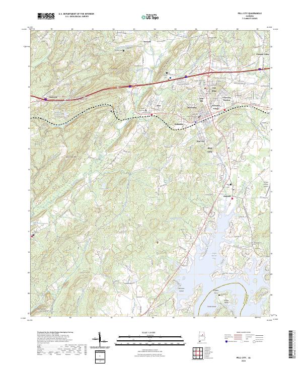
2024 Map of Pell City
USGS Topo · Published 2024About this map
Pell City serves as the focal point for this survey, situated at a transition between the elevated peaks of Chulavista Mountain and Gum Springs Mountain and the expansive waters of Logan Martin Lake. The map details the developed corridors of Eden, Oak Ridge, and Avondale Village, showcasing a landscape deeply influenced by both the Norfolk Southern railroad and the modern interstate. To the south, the map captures the finger-like inlets of the lake where Easonville Creek and Dye Creek meet the reservoir, surrounding landmarks like Harmons Island and Drake Island.
Find a feature on this map
199 named features on this map. Tap any name to fly to it.
Don’t see what you’re looking for? This feature index may not catch every label — zoom into the map to look around manually.
Map Details
Editions of this 2024 Pell City Map
This is the sole edition of this map. No revisions or reprints were ever made.
Other maps of this area

1889 · Springville
USGS Topo · 1:125,000

1890 · Talladega
USGS Topo · 1:125,000

1892 · Springville
USGS Topo · 1:125,000

1892 · Talladega
USGS Topo · 1:125,000

1943 · Talladega
USGS Topo · 1:62,500

1946 · Talladega
USGS Topo · 1:62,500

1947 · Ragland
USGS Topo · 1:62,500

1947 · Ragland
USGS Topo · 1:24,000

1947 · Riverside
USGS Topo · 1:24,000

1951 · Vincent
USGS Topo · 1:24,000
Featured Places
- Pell City, AL
- Griffitts Lake Shore Subdivision, AL
- Pleasant Valley, AL
- Stewarts, AL
- Carl Smith Subdivision, Pell City