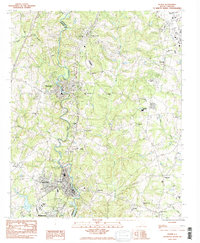
1983 Map of Pelzer
USGS Topo · Published 1983About this map
The Saluda River carves a serpentine path through the heart of the Piedmont region, serving as the historical boundary between Anderson and Greenville counties. This 1983 survey captures the developed industrial and residential corridors of Pelzer and West Pelzer, alongside the smaller settlement of Piedmont to the north. The landscape is dense with community landmarks, particularly country churches like St Matthews Ch and Rehobeth Ch, which speak to the area's rural genealogy.
Find a feature on this map
42 named features on this map. Tap any name to fly to it.
Don’t see what you’re looking for? This feature index may not catch every label — zoom into the map to look around manually.
Map Details
Editions of this 1983 Pelzer Map
2 editions found
Other maps of this area

1888 · Pickens
USGS Topo · 1:125,000

1894 · Pickens
USGS Topo · 1:125,000

1935 · Greenville
USGS Topo · 1:48,000

1938 · Greenville
USGS Topo · 1:62,500

1954 · Greenville
USGS Topo · 1:250,000

1957 · Greenville
USGS Topo · 1:24,000

1957 · Anderson
USGS Topo · 1:62,500

1957 · Easley
USGS Topo · 1:62,500

1957 · Williamston
USGS Topo · 1:62,500

1957 · Greenville
USGS Topo · 1:62,500