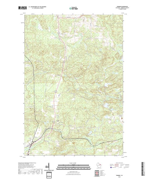
2022 Map of Pembine
USGS Topo · Published 2022About this map
Pembine anchors the southwestern corner of this landscape, where the confluence of local roads and the nearby S Br Pemebonwon River shaped the early footprint of the community. The town's historical geography is documented through features like the Pembine Cem and the nearby Maverick Field, reflecting the persistent patterns of residency in this part of Marinette County. The surrounding terrain is defined by the complex hydrology of the N Br Pemebonwon River and South Branch Pemebonwon River, which create notable landmarks such as Smalley Falls and Long Slide Falls. Numerous small bodies of water, including Wolf Lake, Lake Chapman, and Otter Lake, are scattered throughout the township lines, connected by a network of rural routes like Kremlin Rd and Morgan Park Rd that trace the area's timber and recreational history.
Find a feature on this map
87 named features on this map. Tap any name to fly to it.
Don’t see what you’re looking for? This feature index may not catch every label — zoom into the map to look around manually.
Map Details
Editions of this 2022 Pembine Map
This is the sole edition of this map. No revisions or reprints were ever made.
Other maps of this area

1939 · Pembine
USGS Topo · 1:48,000

1939 · Dunbar
USGS Topo · 1:48,000

1939 · Iron Mountain
USGS Topo · 1:48,000

1941 · Dunbar
USGS Topo · 1:48,000

1941 · Iron Mountain
USGS Topo · 1:48,000

1947 · Pembine
USGS Topo · 1:48,000

1947 · Dunbar
USGS Topo · 1:48,000

1947 · Iron Mountain
USGS Topo · 1:48,000

1954 · Iron Mountain
USGS Topo · 1:250,000

1954 · Escanaba
USGS Topo · 1:250,000