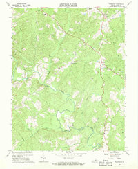
1968 Map of Pendleton
USGS Topo · Published 1970About this map
The South Anna River winds through the heart of Louisa County, defining the rural landscape of central Virginia in the late 1960s. The area is characterized by a network of small, dispersed settlements and crossroads communities, including Pendleton, Cuckoo, and Apple Grove. These hubs are connected by a mix of light-duty and unimproved roads, alongside the prominent Chesapeake and Ohio railroad line cutting through the northern portion of the quadrangle.
Find a feature on this map
28 named features on this map. Tap any name to fly to it.
Don’t see what you’re looking for? This feature index may not catch every label — zoom into the map to look around manually.
Map Details
Editions of this 1968 Pendleton Map
2 editions found
Other maps of this area

1887 · Spottsylvania
USGS Topo · 1:125,000

1890 · Goochland
USGS Topo · 1:125,000

1891 · Palmyra
USGS Topo · 1:125,000

1892 · Spottsylvania
USGS Topo · 1:125,000

1892 · Goochland
USGS Topo · 1:125,000

1892 · Gordonsville
USGS Topo · 1:125,000

1895 · Palmyra
USGS Topo · 1:125,000

1897 · Palmyra
USGS Topo · 1:125,000

1942 · Mineral
USGS Topo · 1:31,680

1942 · Contrary Creek
USGS Topo · 1:31,680