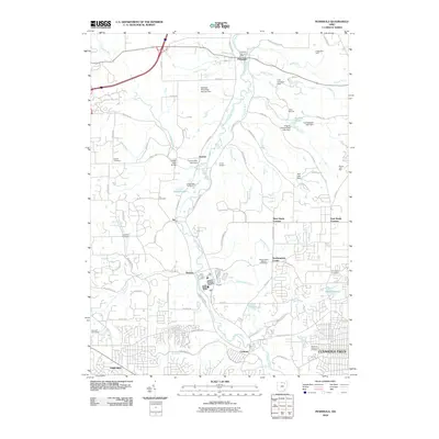
2010 Map of Peninsula
USGS Topo · Published 2010About this map
The Cuyahoga River carves a deep valley through this portion of Summit County, shaping a landscape defined by its riparian infrastructure and early canal-era heritage. Small settlements like Peninsula and Everett are centers of gravity along the river, connected by significant landmarks such as the Everett Road Bridge and the Furnace Run Aqueduct. The area is notably dense with commemorative sites and burial grounds, ranging from the Revere Cemetery and Ira Cemetery in the west to the Northampton Center Cemetery and Chestnut Memorial Cemetery further east. The transition from the rural valley floor to the suburban expansion of Cuyahoga Falls and Fairlawn in the south illustrates the area's development. Numerous camps and parks, including Camp Manatoc and Wyoga Lake Park, indicate the valley's long-standing role as a recreational refuge.
Find a feature on this map
88 named features on this map. Tap any name to fly to it.
Don’t see what you’re looking for? This feature index may not catch every label — zoom into the map to look around manually.
Map Details
Editions of this 2010 Peninsula Map
This is the sole edition of this map. No revisions or reprints were ever made.
Other maps of this area

1903 · Cleveland
USGS Topo · 1:62,500

1903 · Akron
USGS Topo · 1:62,500

1905 · Akron
USGS Topo · 1:62,500

1906 · Kent
USGS Topo · 1:62,500

1906 · Chagrin Falls
USGS Topo · 1:62,500

1908 · Chagrin Falls
USGS Topo · 1:62,500

1950 · Cleveland
USGS Topo · 1:250,000

1953 · Broadview Heights
USGS Topo · 1:24,000

1953 · Twinsburg
USGS Topo · 1:24,000
1953 · Northfield
USGS Topo · 1:24,000