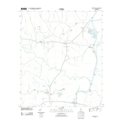
2011 Map of Pennington
USGS Topo · Published 2011About this map
Coffeeville Lake and the winding course of the Tombigbee River dominate the eastern edge of this Alabama landscape, where several historic river landings remain as markers of the region's river-based commerce. Locations such as Kemps Landing, Barrons Landing, and Eureka Landing signify a time when water transport was central to local life. The town of Pennington serves as a hub between these river points and inland settlements like Choctaw City and Deas.
Find a feature on this map
65 named features on this map. Tap any name to fly to it.
Don’t see what you’re looking for? This feature index may not catch every label — zoom into the map to look around manually.
Map Details
Editions of this 2011 Pennington Map
This is the sole edition of this map. No revisions or reprints were ever made.
Other maps of this area

1953 · Montgomery
USGS Topo · 1:250,000

1953 · Meridian
USGS Topo · 1:250,000

1956 · Montgomery
USGS Topo · 1:250,000

1957 · Meridian
USGS Topo · 1:250,000

1957 · Montgomery
USGS Topo · 1:250,000

1965 · Meridian
USGS Topo · 1:250,000

1970 · Myrtlewood North
USGS Topo · 1:24,000

1971 · Whitfield
USGS Topo · 1:24,000

1971 · Gaston
USGS Topo · 1:24,000
1978 · Pennington
USGS Topo · 1:24,000