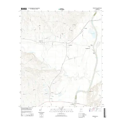
2014 Map of Pennington
USGS Topo · Published 2014About this map
The Tombigbee River forms a wide, winding eastern boundary for this part of Choctaw County, shaping the local geography through its prominent riverfront bluffs and complex drainage system. High points like James Bluff, Tompkins Bluff, and Nanafalia Bluff overlook the water, while the interior is defined by numerous tributaries including Tuckabum Creek and Cotahoma Cr. The settlement pattern reflects the area's timber and industrial heritage, centered around the town of Pennington and the nearby site of Naheola, which contains a substantial Final Mill Effluent Treatment Pon indicating the scale of local river-based industry.
Find a feature on this map
75 named features on this map. Tap any name to fly to it.
Don’t see what you’re looking for? This feature index may not catch every label — zoom into the map to look around manually.
Map Details
Editions of this 2014 Pennington Map
This is the sole edition of this map. No revisions or reprints were ever made.
Other maps of this area

1953 · Montgomery
USGS Topo · 1:250,000

1953 · Meridian
USGS Topo · 1:250,000

1956 · Montgomery
USGS Topo · 1:250,000

1957 · Meridian
USGS Topo · 1:250,000

1957 · Montgomery
USGS Topo · 1:250,000

1965 · Meridian
USGS Topo · 1:250,000

1970 · Myrtlewood North
USGS Topo · 1:24,000

1971 · Whitfield
USGS Topo · 1:24,000

1971 · Gaston
USGS Topo · 1:24,000
1978 · Pennington
USGS Topo · 1:24,000