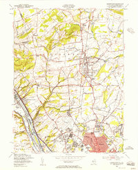
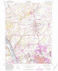
1954 Map of Pennington
USGS Topo · Published 1956About this map
The Delaware River and the adjacent Delaware and Raritan Canal form the western boundary of this New Jersey landscape, which was undergoing significant institutional and suburban expansion by the mid-1950s. The southern portion of the sheet is marked by major public works and educational campuses, including the Mercer County Airport and the expansive grounds of the New Jersey State Teachers College and the State School for Deaf. While the borough of Pennington serves as a central hub, the surrounding terrain is dotted with long-established crossroads and hamlets such as Bear Tavern, Harbourton, and Marshalls Corners. The map provides a detailed view of the Reading railroad corridor and the northern ridges of Pennington Mountain and Baldpate Mountain, showcasing a region balancing its agrarian roots with growing civic infrastructure and early mid-century residential developments like Braeburn Heights.
Find a feature on this map
87 named features on this map. Tap any name to fly to it.
Don’t see what you’re looking for? This feature index may not catch every label — zoom into the map to look around manually.
Map Details
Editions of this 1954 Pennington Map
6 editions found

Other maps of this area

1888 · Bordentown
USGS Topo · 1:62,500

1888 · Princeton
USGS Topo · 1:62,500

1890 · Lambertville
USGS Topo · 1:62,500

1890 · Burlington
USGS Topo · 1:62,500

1891 · Lambertville
USGS Topo · 1:62,500

1893 · Bordentown
USGS Topo · 1:62,500

1893 · Burlington
USGS Topo · 1:62,500

1894 · Princeton
USGS Topo · 1:62,500

1894 · Lambertville
USGS Topo · 1:62,500

1904 · Burlington
USGS Topo · 1:62,500
Featured Places
- Ewing Township, NJ
- Lawrence Township, NJ
- Lower Makefield Township, PA
- Hopewell Township, NJ
- Upper Makefield Township, PA