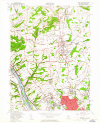
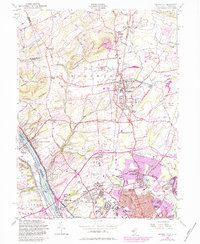
1954 Map of Pennington
USGS Topo · Published 1961About this map
Pennington Mountain and Baldpate Mountain rise over the landscape, overlooking a network of colonial-era crossroads and evolving mid-century institutions. The area is anchored by the Pennington borough, with several family-named landmarks such as Ackors Corner, Harts Corner, and Marshalls Corners marking the intersections of Bear Tavern Road and Brunswick Avenue. Near the Delaware River, the map highlights the significance of Washington State Park at Washington Crossing, documenting the commemorative landscape alongside the Reading railroad line.
Find a feature on this map
86 named features on this map. Tap any name to fly to it.
Don’t see what you’re looking for? This feature index may not catch every label — zoom into the map to look around manually.
Map Details
Editions of this 1954 Pennington Map
6 editions found

Other maps of this area

1888 · Bordentown
USGS Topo · 1:62,500

1888 · Princeton
USGS Topo · 1:62,500

1890 · Lambertville
USGS Topo · 1:62,500

1890 · Burlington
USGS Topo · 1:62,500

1891 · Lambertville
USGS Topo · 1:62,500

1893 · Bordentown
USGS Topo · 1:62,500

1893 · Burlington
USGS Topo · 1:62,500

1894 · Princeton
USGS Topo · 1:62,500

1894 · Lambertville
USGS Topo · 1:62,500

1904 · Burlington
USGS Topo · 1:62,500
Featured Places
- Ewing Township, NJ
- Lawrence Township, NJ
- Lower Makefield Township, PA
- Hopewell Township, NJ
- Upper Makefield Township, PA