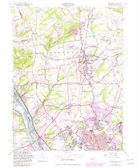
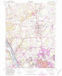
1954 Map of Pennington
USGS Topo · Published 1982About this map
The Delaware River forms a natural border in this mid-century survey, anchoring the storied ground of Washington Crossing State Park and the settlement of Washington Crossing. To the east, the borough of Pennington serves as a local hub, surrounded by a network of crossroads like Bear Tavern, Harts Corner, and Ackors Corner. The landscape transitions from the heights of Baldpate Mountain and Pennington Mountain toward the developing suburbs and institutions of the south. Significant local landmarks include the New Jersey State Teachers College and the Mercer County Airport, alongside specialized sites like the State School For Deaf and the U S Naval Reservation. The presence of the Conrail line and numerous cemeteries, such as Ewing Cemetery and St Hedwigs Cem, provide valuable reference points for tracing the community's mid-century expansion and ancestral locations.
Find a feature on this map
89 named features on this map. Tap any name to fly to it.
Don’t see what you’re looking for? This feature index may not catch every label — zoom into the map to look around manually.
Map Details
Editions of this 1954 Pennington Map
6 editions found

Other maps of this area

1888 · Bordentown
USGS Topo · 1:62,500

1888 · Princeton
USGS Topo · 1:62,500

1890 · Lambertville
USGS Topo · 1:62,500

1890 · Burlington
USGS Topo · 1:62,500

1891 · Lambertville
USGS Topo · 1:62,500

1893 · Bordentown
USGS Topo · 1:62,500

1893 · Burlington
USGS Topo · 1:62,500

1894 · Princeton
USGS Topo · 1:62,500

1894 · Lambertville
USGS Topo · 1:62,500

1904 · Burlington
USGS Topo · 1:62,500
Featured Places
- Ewing Township, NJ
- Lawrence Township, NJ
- Lower Makefield Township, PA
- Hopewell Township, NJ
- Upper Makefield Township, PA