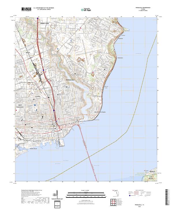
2024 Map of Pensacola
USGS Topo · Published 2024About this map
Pensacola and its surrounding coastal communities are defined by the intricate relationship between the urban core and the expansive waters of Escambia Bay and Pensacola Bay. This modern survey reveals a dense network of neighborhoods like West Pensacola, Goulding, and Ferry Pass, while highlighting the city's complex genealogical landscape through its numerous burial grounds. From the Old Pensacola City Cem near the historic center to the Miraflores Park Unofficial African Cem and Temple Beth-El Cem, these sites offer a profound map of the area's diverse cultural heritage.
Find a feature on this map
57 named features on this map. Tap any name to fly to it.
Don’t see what you’re looking for? This feature index may not catch every label — zoom into the map to look around manually.
Map Details
Editions of this 2024 Pensacola Map
This is the sole edition of this map. No revisions or reprints were ever made.
Other maps of this area

1920 · Milton
USGS Topo · 1:62,500

1921 · Pensacola
USGS Topo · 1:62,500

1921 · Fort Barrancas
USGS Topo · 1:62,500

1921 · Muscogee
USGS Topo · 1:62,500

1941 · Fort Barrancas
USGS Topo · 1:62,500

1941 · Muscogee
USGS Topo · 1:62,500

1941 · Pensacola
USGS Topo · 1:62,500

1941 · Milton
USGS Topo · 1:62,500

1942 · Pensacola
USGS Topo · 1:62,500

1943 · Muscogee
USGS Topo · 1:62,500