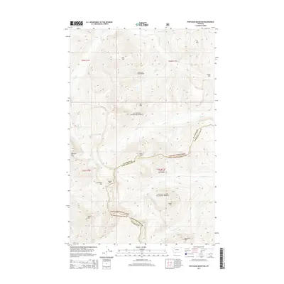
2014 Map of Pentagon Mountain
USGS Topo · Published 2014About this map
The Lewis and Clark Range dominates this portion of the northern Rockies, where the border between the Flathead National Forest and Lewis & Clark National Forest follows the high continental divide. This mountainous landscape is defined by its drainage systems, with Basin Cr and Park Cr carving deep valleys between prominent massifs like Pentagon Mtn and Clack Mtn. The map reveals a high-altitude wilderness at the turn of the 21st century, punctuated by clear alpine water bodies such as Dean Lake and Lake Levale. Notable peaks like Moonlight Peak and Table Mtn anchor the southern reaches of the survey, while Switchback Pass indicates the traditional routes used to traverse this complex terrain. The presence of the Flathead Co and Lewis and Clark Co line underscores how political boundaries often align with these formidable natural ridges.
Find a feature on this map
30 named features on this map. Tap any name to fly to it.
Don’t see what you’re looking for? This feature index may not catch every label — zoom into the map to look around manually.
Map Details
Editions of this 2014 Pentagon Mountain Map
This is the sole edition of this map. No revisions or reprints were ever made.
Other maps of this area

1903 · Saypo
USGS Topo · 1:125,000

1913 · Marias Pass
USGS Topo · 1:125,000

1914 · Heart Butte
USGS Topo · 1:125,000

1918 · Heart Butte
USGS Topo · 1:125,000

1936 · Silvertip
USGS Topo · 1:96,000

1942 · Silvertip
USGS Topo · 1:125,000

1955 · Choteau
USGS Topo · 1:250,000

1957 · Choteau
USGS Topo · 1:250,000

1958 · Choteau
USGS Topo · 1:250,000

1958 · Gable Peaks
USGS Topo · 1:24,000