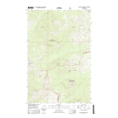
2017 Map of Pentagon Mountain
USGS Topo · Published 2017About this map
Pentagon Mtn stands as the central landmark in this high-altitude section of the Lewis and Clark Range, where the continental divide meets the boundaries of two major national forests. This 2017 survey details the complex topography at the junction of Flathead National Forest and Lewis & Clark National Forest, specifically where Flathead County and Lewis and Clark County meet. The map documents a primitive network of high-country routes, most notably the crossing at Switchback Pass south of Kevan Mtn.
Find a feature on this map
26 named features on this map. Tap any name to fly to it.
Don’t see what you’re looking for? This feature index may not catch every label — zoom into the map to look around manually.
Map Details
Editions of this 2017 Pentagon Mountain Map
This is the sole edition of this map. No revisions or reprints were ever made.
Other maps of this area

1903 · Saypo
USGS Topo · 1:125,000

1913 · Marias Pass
USGS Topo · 1:125,000

1914 · Heart Butte
USGS Topo · 1:125,000

1918 · Heart Butte
USGS Topo · 1:125,000

1936 · Silvertip
USGS Topo · 1:96,000

1942 · Silvertip
USGS Topo · 1:125,000

1955 · Choteau
USGS Topo · 1:250,000

1957 · Choteau
USGS Topo · 1:250,000

1958 · Choteau
USGS Topo · 1:250,000

1958 · Gable Peaks
USGS Topo · 1:24,000