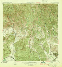
1946 Map of Penuelas
USGS Topo · Published 1946About this map
Peñuelas serves as the inland hub of this mid-century survey, situated at the base of the Cordillera Central where the Río Tallaboa descends toward the coast. The landscape reveals a complex network of industrial and educational infrastructure, notably featuring the Salto Garzas Planta Hidroelectrica No. 1 and its counterpart No. 2, indicating the significant hydroelectric development of the era. To the north, the Bosque Insular de Guilarte covers the high ridges, including the prominent Cerrote de Peñuelas.
Find a feature on this map
34 named features on this map. Tap any name to fly to it.
Don’t see what you’re looking for? This feature index may not catch every label — zoom into the map to look around manually.
Map Details
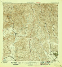
Editions of this 1946 Penuelas Map
3 editions found
Other maps of this area

1945 · Playa De Ponce
USGS Topo · 1:30,000

1945 · Ponce
USGS Topo · 1:30,000

1946 · Punta Cuchara
USGS Topo · 1:30,000

1946 · Yauco
USGS Topo · 1:30,000

1946 · Jayuya
USGS Topo · 1:30,000

1946 · Monte Guilarte
USGS Topo · 1:30,000

1946 · Punta Verraco
USGS Topo · 1:30,000

1946 · Penuelas
USGS Topo · 1:30,000

1946 · Adjuntas
USGS Topo · 1:30,000
1947 · Yauco NE
USGS Topo · 1:10,000
Featured Places
- Peñuelas
- Sector La Gelpa, Peñuelas
- Sector La Vaquería, Ponce
- Sector Loyola, Peñuelas
- Sector Los Cruz, Ponce