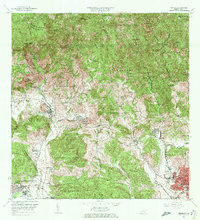
1964 Map of Penuelas
USGS Topo · Published 1972About this map
The Cordillera Central defines the northern reaches of this mid-century landscape, where rugged peaks like Cerro de Peñuelas and Cerro Mata de Plátano descend into a complex system of river valleys and agricultural estates. The town of Peñuelas sits as a central hub, while the southern plains near Tallaboa Poniente show the shift toward industrialization with the Refinería de Petróleo. This era is characterized by the persistence of the hacienda system alongside modernizing infrastructure, with numerous family-named estates such as Hacienda La Milagrosa, Hacienda Dolores, and Hacienda San Antonio dotting the terrain.
Find a feature on this map
115 named features on this map. Tap any name to fly to it.
Don’t see what you’re looking for? This feature index may not catch every label — zoom into the map to look around manually.
Map Details
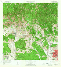
Editions of this 1964 Penuelas Map
2 editions found
Other maps of this area

1945 · Playa De Ponce
USGS Topo · 1:30,000

1945 · Ponce
USGS Topo · 1:30,000

1946 · Punta Cuchara
USGS Topo · 1:30,000

1946 · Yauco
USGS Topo · 1:30,000

1946 · Jayuya
USGS Topo · 1:30,000

1946 · Monte Guilarte
USGS Topo · 1:30,000

1946 · Punta Verraco
USGS Topo · 1:30,000

1946 · Penuelas
USGS Topo · 1:30,000

1946 · Adjuntas
USGS Topo · 1:30,000
1947 · Yauco NE
USGS Topo · 1:10,000
Featured Places
- Peñuelas
- Sector La Gelpa, Peñuelas
- Sector La Vaquería, Ponce
- Sector Loyola, Peñuelas
- Sector Los Cruz, Ponce