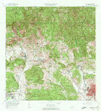
1972 Map of Penuelas
USGS Topo · Published 1982About this map
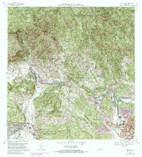
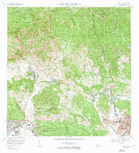
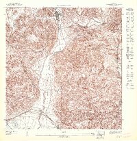
Tallaboa Alta and the surrounding barrios represent a transition from the mountainous interior to the urbanized coastal plains during the early 1970s. The landscape is defined by the steep relief of Mata de Platano and Cerro del Diablo in the north, which give way to the productive valleys of the Rio Tallaboa. This 1972 revision shows the increasing urbanization of the Ponce city limits, with developments like Jardines del Caribe and El Madrigal pushing into former agricultural zones. Researchers can find significant cultural landmarks such as the Iglesia San Jose and the Cementerio San Vicente de Paul. The map also captures local infrastructure of the era, including the Escuela Eduardo Neumann Gandia and the Albergue de Niños, providing a record of community life in Tallaboa and Canas before later regional developments.
Find a feature on this map
65 named features on this map. Tap any name to fly to it.
Don’t see what you’re looking for? This feature index may not catch every label — zoom into the map to look around manually.
Map Details
Editions of this 1972 Penuelas Map
2 editions found
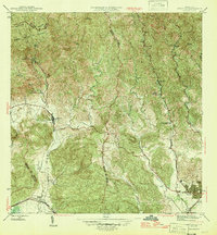
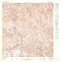
Historical Maps of Peñuelas Through Time
11 maps found
1946 Penuelas
Peñuelas Municipio, PR
1947 Penuelas NO
Peñuelas Municipio, PR
1947 Penuelas SO
Peñuelas Municipio, PR
1947 Punta Gughara NO
Peñuelas Municipio, PR
1952 Penuelas
Peñuelas Municipio, PR
1958 Penuelas
Peñuelas Municipio, PR
1964 Penuelas
Peñuelas Municipio, PR
1972 Penuelas
Peñuelas Municipio, PR
2013 Penuelas
Peñuelas Municipio, PR
2018 Penuelas
Peñuelas Municipio, PR
2024 Penuelas
Peñuelas Municipio, PR
Featured Locations
- Peñuelas, Peñuelas
- Sector La Gelpa, Peñuelas
- Sector Loyola, Peñuelas
- Sector Los Cruz, Ponce
- Sector La Vaquería, Ponce