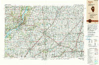
1990 Map of Peoria
USGS Topo · Published 1990About this map
The Illinois River corridor anchors this regional landscape, serving as a vital industrial and transport artery for Peoria and Pekin as they appeared at the start of the 1990s. This survey illustrates the extensive urban development of central Illinois, highlighting the twin educational hubs of Illinois State University in Normal and the University of Illinois in the Urbana and Champaign area.
Find a feature on this map
75 named features on this map. Tap any name to fly to it.
Don’t see what you’re looking for? This feature index may not catch every label — zoom into the map to look around manually.
Map Details
Editions of this 1990 Peoria Map
This is the sole edition of this map. No revisions or reprints were ever made.
Other maps of this area

1893 · Lacon
USGS Topo · 1:62,500

1893 · Metamora
USGS Topo · 1:62,500

1893 · Dunlap
USGS Topo · 1:62,500

1898 · Dunlap
USGS Topo · 1:62,500

1905 · Peoria
USGS Topo · 1:62,500

1906 · Urbana
USGS Topo · 1:62,500

1907 · Springfield
USGS Topo · 1:62,500

1907 · Mahomet
USGS Topo · 1:62,500

1909 · Tallula
USGS Topo · 1:62,500

1911 · Lincoln
USGS Topo · 1:62,500