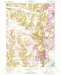
1949 Map of Peoria West
USGS Topo · Published 1968About this map
The Peoria State Hospital and its associated State Hospital Farm anchor the southern landscape of this 1949 survey, which was updated in 1967 to show the expanding footprint of Peoria and Bartonville. The topography is defined by the sharp ravines and bluffs leading down to the Illinois River, notably around the distinctive curve of Horseshoe Bottom. A heavy industrial and transportation network is evident, with multiple rail lines including the Chicago and North Western and Chicago Burlington and Quincy cutting through the valleys.
Find a feature on this map
59 named features on this map. Tap any name to fly to it.
Don’t see what you’re looking for? This feature index may not catch every label — zoom into the map to look around manually.
Map Details
Editions of this 1949 Peoria West Map
3 editions found

Other maps of this area

1893 · Dunlap
USGS Topo · 1:62,500

1898 · Dunlap
USGS Topo · 1:62,500

1905 · Peoria
USGS Topo · 1:62,500

1927 · Peoria
USGS Topo · 1:62,500

1930 · Glasford
USGS Topo · 1:62,500

1932 · Dunlap
USGS Topo · 1:62,500

1933 · Dunlap
USGS Topo · 1:62,500

1937 · Dunlap
USGS Topo · 1:62,500

1944 · Elmwood
USGS Topo · 1:62,500

1948 · Elmwood
USGS Topo · 1:62,500