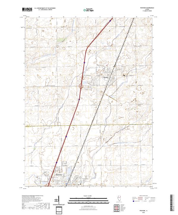
2024 Map of Peotone
USGS Topo · Published 2024About this map
Peotone and Manteno sit at the center of this 2024 landscape, marking a transition across the Will and Kankakee county line. The area is defined by its complex drainage network, where Rock Creek and Black Walnut Creek carve through the agricultural plains. To the north, South Branch Forked Creek winds toward the village, while southern reaches are shaped by Marshall Slough and Extine Slough. Local history is anchored by several long-standing burial grounds, including Peotone Cemetery and Saint Joseph Cemetery. The road network follows a rigid section-line grid, including prominent routes like Wilmington Peotone Road and 11000N Road, illustrating the persistence of early land-division patterns in this modern topographic survey.
Find a feature on this map
28 named features on this map. Tap any name to fly to it.
Don’t see what you’re looking for? This feature index may not catch every label — zoom into the map to look around manually.
Map Details
Editions of this 2024 Peotone Map
This is the sole edition of this map. No revisions or reprints were ever made.
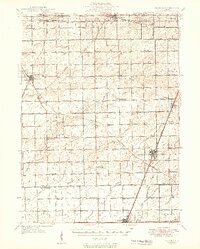
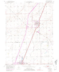
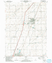
Historical Maps of Manteno Through Time
4 maps found