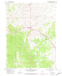
1968 Map of Pequop Summit
USGS Topo · Published 1983About this map
Pequop Summit serves as the central crossing for this high-altitude landscape in Elko County, where the Pequop Mountains divide the terrain. This 1960s survey, with updates from the early 1980s, documents the infrastructure required for navigation and communication in this remote mountain pass, including an Airway Beacon and a Radio Facility near Rocky Point. The natural topography is defined by sharp elevation changes and numerous water sources that sustain the local environment.
Find a feature on this map
14 named features on this map. Tap any name to fly to it.
Don’t see what you’re looking for? This feature index may not catch every label — zoom into the map to look around manually.
Map Details
Editions of this 1968 Pequop Summit Map
3 editions found
Other maps of this area

1955 · Wells
USGS Topo · 1:250,000

1955 · Elko
USGS Topo · 1:250,000

1958 · Wells
USGS Topo · 1:250,000

1958 · Elko
USGS Topo · 1:250,000

1961 · Wells
USGS Topo · 1:250,000

1962 · Elko
USGS Topo · 1:250,000

1965 · Elko
USGS Topo · 1:250,000

1967 · Valley Pass
USGS Topo · 1:24,000

1967 · Cobre
USGS Topo · 1:24,000

1968 · Independence Valley NE
USGS Topo · 1:24,000