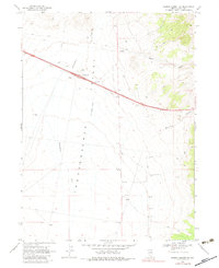
1968 Map of Pequop Summit SW
USGS Topo · Published 1983About this map
Independence Valley dominates this high desert landscape in Elko County, showing a sparse infrastructure of ranching and transit during the late 1960s. The topographic detail focuses on the arid drainage patterns of Independence Creek and Squaw Creek as they descend from the higher elevations of Maverick Canyon. Evidence of human activity is limited to a network of Jeep Trails and essential water infrastructure such as Independence Well and several other labeled Dry Wells, reflecting the challenges of this environment. The arrival of modern transportation is centered on the Independence Interchange, while industrial utility is noted through scattered Gravel Pits and a solitary Drill Hole. This survey provides a clear view of the open range before extensive later development, preserved as it was field checked in 1968.
Find a feature on this map
11 named features on this map. Tap any name to fly to it.
Don’t see what you’re looking for? This feature index may not catch every label — zoom into the map to look around manually.
Map Details
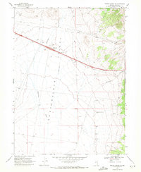
Editions of this 1968 Pequop Summit SW Map
2 editions found
Other maps of this area

1955 · Wells
USGS Topo · 1:250,000

1955 · Elko
USGS Topo · 1:250,000

1958 · Wells
USGS Topo · 1:250,000

1958 · Elko
USGS Topo · 1:250,000

1961 · Wells
USGS Topo · 1:250,000

1962 · Elko
USGS Topo · 1:250,000

1965 · Elko
USGS Topo · 1:250,000

1968 · Moor Summit
USGS Topo · 1:24,000

1968 · Independence Valley NE
USGS Topo · 1:24,000

1968 · Holborn
USGS Topo · 1:24,000