
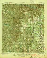
1944 Map of Perdido
USGS Topo · Published 1944About this map
Atmore and its surrounding coastal plain communities are detailed during the mid-1940s, revealing a landscape defined by the convergence of the St Louis - San Francisco RR and several local transit lines. The map documents a rural network of schools and churches, such as Judson Ch, Travelers Rest Ch, and the Langham Lottie Sch, which served the scattered timber and farming settlements. Evidence of the region's industrial ties to forestry is visible through the Logging RR branching through the center of the sheet and the inclusion of the Atmore Airport at the edge of the growing town.
Find a feature on this map
56 named features on this map. Tap any name to fly to it.
Don’t see what you’re looking for? This feature index may not catch every label — zoom into the map to look around manually.
Map Details
Editions of this 1944 Perdido Map
2 editions found
Other maps of this area

1941 · Bay Minette
USGS Topo · 1:62,500

1941 · Century
USGS Topo · 1:62,500

1942 · Perdido
USGS Topo · 1:62,500

1942 · Dyas
USGS Topo · 1:62,500

1943 · Century
USGS Topo · 1:62,500

1943 · Bay Minette
USGS Topo · 1:62,500

1943 · Choctaw Bluff
USGS Topo · 1:62,500

1943 · Tensaw
USGS Topo · 1:62,500

1944 · Tensaw
USGS Topo · 1:62,500

1944 · Dyas
USGS Topo · 1:62,500