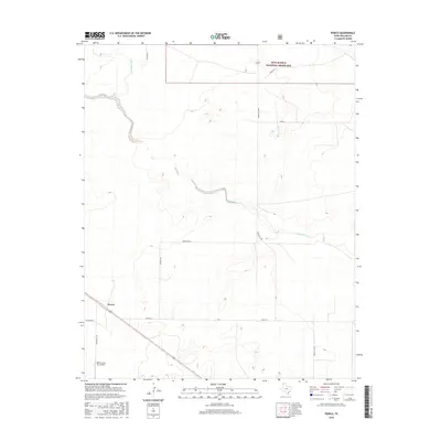
2016 Map of Perico
USGS Topo · Published 2016About this map
Perico serves as the primary focal point of this Dallam County landscape, situated along the railroad line in a region defined by its wide plains and deep-cut drainage systems. The map illustrates a transition from private agricultural holdings to the public lands of the Rita Blanca National Grassland in the northern reaches of the quadrangle. Hydrological patterns are dominated by the branching arms of Rita Blanca Creek, including E Rita Blanca Creek and W Rita Blanca Creek, which carve winding paths through the terrain. Evidence of the local ranching and transport network is visible through named rural thoroughfares such as Tamplin Road and O Bar Lane, while the Nebtex Land Co. Airport provides a modern navigational landmark for this corner of the Texas Panhandle.
Find a feature on this map
15 named features on this map. Tap any name to fly to it.
Don’t see what you’re looking for? This feature index may not catch every label — zoom into the map to look around manually.
Map Details
Editions of this 2016 Perico Map
This is the sole edition of this map. No revisions or reprints were ever made.
Other maps of this area

1954 · Dalhart
USGS Topo · 1:250,000

1958 · Dalhart
USGS Topo · 1:250,000

1962 · Dalhart
USGS Topo · 1:250,000

1973 · Buffalo Springs
USGS Topo · 1:24,000

1973 · Wharton Ranch
USGS Topo · 1:24,000

1973 · Tovrea Ranch
USGS Topo · 1:24,000

1973 · Corlena
USGS Topo · 1:24,000

1973 · Perico
USGS Topo · 1:24,000
1973 · Corlena NW
USGS Topo · 1:24,000

1973 · Bolin
USGS Topo · 1:24,000