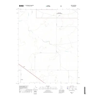
2019 Map of Perico
USGS Topo · Published 2019About this map
Perico anchors the southwestern corner of this survey in the High Plains of Dallam County, serving as a focal point for the surrounding cattle country. The landscape is defined by the drainage of Rita Blanca Cr and its tributary, W Rita Blanca Cr, which wind across the terrain toward the northeast. This 2019 data illustrates the modern intersection of private ranching and protected public lands, notably the Rita Blanca National Grassland in the northern portion of the map. Evidence of the local aviation and agricultural infrastructure is found at the Nebtex Land Co Airport, while a network of rural routes like Ranch Rd 1879 and Metcalf Rd connect isolated ranch holdings across the vast Texas Panhandle.
Find a feature on this map
14 named features on this map. Tap any name to fly to it.
Don’t see what you’re looking for? This feature index may not catch every label — zoom into the map to look around manually.
Map Details
Editions of this 2019 Perico Map
This is the sole edition of this map. No revisions or reprints were ever made.
Other maps of this area

1954 · Dalhart
USGS Topo · 1:250,000

1958 · Dalhart
USGS Topo · 1:250,000

1962 · Dalhart
USGS Topo · 1:250,000

1973 · Buffalo Springs
USGS Topo · 1:24,000

1973 · Wharton Ranch
USGS Topo · 1:24,000

1973 · Tovrea Ranch
USGS Topo · 1:24,000

1973 · Corlena
USGS Topo · 1:24,000

1973 · Perico
USGS Topo · 1:24,000
1973 · Corlena NW
USGS Topo · 1:24,000

1973 · Bolin
USGS Topo · 1:24,000