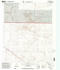
1998 Map of Perico
USGS Topo · Published 2001About this map
Perico stands as the primary rail-side settlement in this high-plains landscape of the Texas Panhandle, positioned along a prominent railroad line and highway corridor. The geography is defined by the winding course of Rita Blanca Creek, which branches into East and West forks as it moves through the northern reaches of the quadrangle. A significant portion of the territory is managed as the Rita Blanca National Grassland, reflecting a transition in land use toward conservation and grazing after the mid-century. This 1990s revision documents a sparsely populated but industrially active area, marked by a subterranean Pipeline and a local Gravel Pit. The map provides a clear look at the hydraulic infrastructure of the plains, where numerous wells are dispersed across the terrain to support agriculture and ranching in an arid environment.
Find a feature on this map
8 named features on this map. Tap any name to fly to it.
Don’t see what you’re looking for? This feature index may not catch every label — zoom into the map to look around manually.
Map Details
Editions of this 1998 Perico Map
This is the sole edition of this map. No revisions or reprints were ever made.
Other maps of this area

1954 · Dalhart
USGS Topo · 1:250,000

1958 · Dalhart
USGS Topo · 1:250,000

1962 · Dalhart
USGS Topo · 1:250,000

1973 · Buffalo Springs
USGS Topo · 1:24,000

1973 · Wharton Ranch
USGS Topo · 1:24,000

1973 · Tovrea Ranch
USGS Topo · 1:24,000

1973 · Corlena
USGS Topo · 1:24,000

1973 · Perico
USGS Topo · 1:24,000
1973 · Corlena NW
USGS Topo · 1:24,000

1973 · Bolin
USGS Topo · 1:24,000