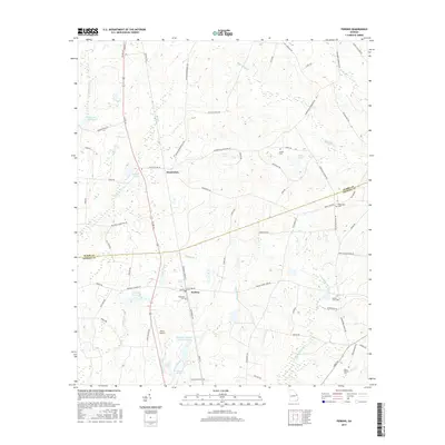
2017 Map of Perkins
USGS Topo · Published 2017About this map
Perkins and Munnerlyn serve as the primary hubs for this rural landscape along the Burke Co and Jenkins Co border. The map detail highlights a well-established network of family-named roads, including Alexander Munnerlyn Rd and McClain Bell Rd, which connect various agricultural properties and small rural communities. The southern portion of the quadrangle is dominated by the natural and recreational features of Magnolia Springs State Park, which includes Magnolia Spring and Magnolia Springs State Park Lake. Genealogy researchers will find significant value in the distribution of local burial grounds, such as Lawtonville Cem, Magnolia Cem, and Green Fork Cem. The terrain is defined by a gentle drainage system featuring Little Buckhead Cr, Dooley Br, and Rosemary Cr, while the Millen Airport provides a modern utility near the southern boundary.
Find a feature on this map
74 named features on this map. Tap any name to fly to it.
Don’t see what you’re looking for? This feature index may not catch every label — zoom into the map to look around manually.
Map Details
Editions of this 2017 Perkins Map
This is the sole edition of this map. No revisions or reprints were ever made.
Other maps of this area

1919 · Gough
USGS Topo · 1:62,500

1920 · Millen
USGS Topo · 1:62,500

1920 · Greens Cut
USGS Topo · 1:62,500

1943 · Greens Cut
USGS Topo · 1:62,500

1943 · Millen
USGS Topo · 1:62,500

1943 · Augusta East
USGS Topo · 1:125,000

1943 · Millen
USGS Topo · 1:125,000

1947 · Savannah
USGS Topo · 1:250,000

1948 · Savannah
USGS Topo · 1:250,000

1948 · Gough
USGS Topo · 1:62,500