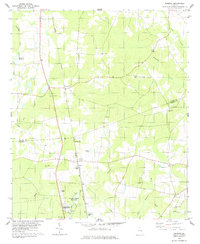
1978 Map of Perkins
USGS Topo · Published 1978About this map
Magnolia Springs State Park and the adjacent Millen National Fish Hatchery anchor the southern portion of this landscape, where the natural Spring waters feed into Mill Creek. The terrain is defined by the agricultural and rural character of the Burke and Jenkins county line, with the Central of Georgia railroad corridor providing a north-south axis through the small settlements of Munnerlyn and Perkins.
Find a feature on this map
30 named features on this map. Tap any name to fly to it.
Don’t see what you’re looking for? This feature index may not catch every label — zoom into the map to look around manually.
Map Details
Editions of this 1978 Perkins Map
This is the sole edition of this map. No revisions or reprints were ever made.
Other maps of this area

1919 · Gough
USGS Topo · 1:62,500

1920 · Millen
USGS Topo · 1:62,500

1920 · Greens Cut
USGS Topo · 1:62,500

1943 · Greens Cut
USGS Topo · 1:62,500

1943 · Millen
USGS Topo · 1:62,500

1943 · Augusta East
USGS Topo · 1:125,000

1943 · Millen
USGS Topo · 1:125,000

1947 · Savannah
USGS Topo · 1:250,000

1948 · Savannah
USGS Topo · 1:250,000

1948 · Gough
USGS Topo · 1:62,500