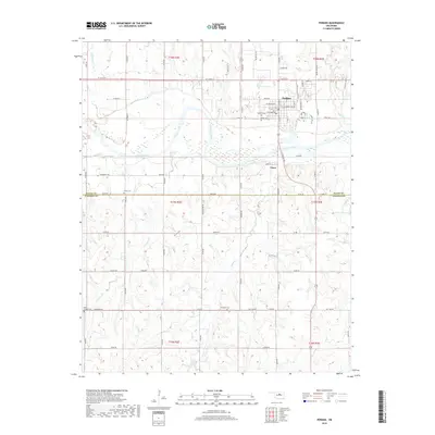
2018 Map of Perkins
USGS Topo · Published 2018About this map
The Cimarron River winds across this central Oklahoma landscape, defining the geographic divide between the northern settlements and the southern drainage basins. The town of Perkins serves as the primary hub, where local history is anchored by the Perkins Cem and Knipe Cem. Further south, the map reveals a pattern of rural connectivity and land use, with the small community of Vinco and a network of section-line roads like Oil Field Rd and Jog Line Rd that cross the watersheds of Corduroy Cr and Dugout Cr. This 2018 survey also delineates the border between Payne and Lincoln Counties, providing a clear look at how contemporary land management, including the 08117 Reservoir, fits into the historical grid established by the Public Land Survey System. For genealogists, the distribution of burial sites like Olivet Cem, Brandon Cem, and Iowa Chapel Cem offers essential clues for tracing family histories across these township lines.
Find a feature on this map
67 named features on this map. Tap any name to fly to it.
Don’t see what you’re looking for? This feature index may not catch every label — zoom into the map to look around manually.
Map Details
Editions of this 2018 Perkins Map
This is the sole edition of this map. No revisions or reprints were ever made.
Other maps of this area

1893 · Stillwater
USGS Topo · 1:62,500

1908 · Agra
USGS Topo · 1:62,500

1909 · Perkins
USGS Topo · 1:62,500

1929 · Ripley
USGS Topo · 1:62,500

1932 · Ripley
USGS Topo · 1:62,500

1954 · Oklahoma City
USGS Topo · 1:250,000

1955 · Enid
USGS Topo · 1:250,000

1957 · Oklahoma City
USGS Topo · 1:250,000

1958 · Enid
USGS Topo · 1:250,000

1963 · Oklahoma City
USGS Topo · 1:250,000