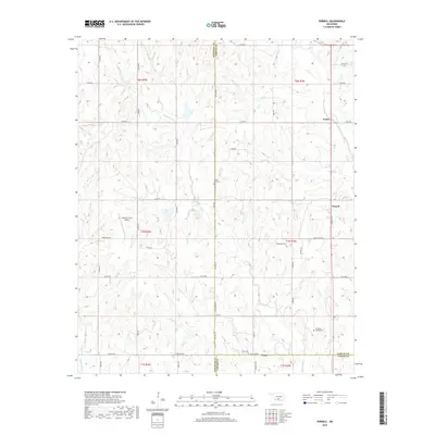
2018 Map of Pernell
USGS Topo · Published 2018About this map
Foster and Pernell anchor this survey of south-central Oklahoma, where the landscape is defined by the headwaters of Sandy Bear Cr and Salt Cr. Located at the intersection of Garvin, Stephens, and Carter counties, the area maintains its rural character through established family landmarks and small community centers. The map provides significant detail for local historians, documenting several burial grounds including Sandy Bear Cem, Robberson Cem, and Dripping Springs Cem. At the southern edge, the settlement of Tussy sits near the border of Stephens and Carter counties, marked by Tussy Cem and a network of section line roads like Baseline RD. The presence of the Newman Farm Airport near Camelback RD highlights the local aviation infrastructure that serves these spread-out agricultural communities.
Find a feature on this map
41 named features on this map. Tap any name to fly to it.
Don’t see what you’re looking for? This feature index may not catch every label — zoom into the map to look around manually.
Map Details
Editions of this 2018 Pernell Map
This is the sole edition of this map. No revisions or reprints were ever made.
Other maps of this area

1898 · Pauls Valley
USGS Topo · 1:125,000

1901 · Addington
USGS Topo · 1:125,000

1901 · Ardmore
USGS Topo · 1:125,000

1902 · Pauls Valley
USGS Topo · 1:125,000

1902 · Rush Springs
USGS Topo · 1:125,000

1918 · Ardmore
USGS Topo · 1:125,000

1957 · Ardmore
USGS Topo · 1:250,000

1963 · Ardmore
USGS Topo · 1:250,000
1969 · Elmore City North
USGS Topo · 1:24,000
1969 · Elmore City South
USGS Topo · 1:24,000