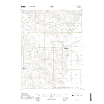
2021 Map of Perry East
USGS Topo · Published 2021About this map
The village of Perry and the community of Chambersburg anchor this landscape along the border of Brown and Pike Counties. The terrain is deeply defined by the winding course of McKee Creek and its complex network of tributaries, including the Middle Fork McKee Creek and South Fork McKee Creek. Numerous family and community burial grounds, such as Newenham Cem, Calhoun Cem, and Dorsey Cem, are scattered across the uplands, providing essential spatial data for genealogical research in this rural Illinois river valley.
Find a feature on this map
95 named features on this map. Tap any name to fly to it.
Don’t see what you’re looking for? This feature index may not catch every label — zoom into the map to look around manually.
Map Details
Editions of this 2021 Perry East Map
This is the sole edition of this map. No revisions or reprints were ever made.
Other maps of this area

1924 · Griggsville
USGS Topo · 1:62,500

1926 · Griggsville
USGS Topo · 1:62,500

1926 · Pittsfield
USGS Topo · 1:62,500

1926 · Mt Sterling
USGS Topo · 1:62,500

1928 · Meredosia
USGS Topo · 1:62,500

1929 · Mt Sterling
USGS Topo · 1:62,500

1931 · Meredosia
USGS Topo · 1:62,500

1948 · Quincy
USGS Topo · 1:250,000

1956 · Quincy
USGS Topo · 1:250,000
1975 · Meredosia SE
USGS Topo · 1:24,000