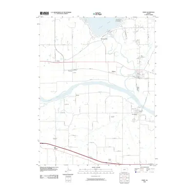
2009 Map of Perry
USGS Topo · Published 2009About this map
The Kansas River flows through the heart of this landscape, a critical waterway flanked by the settlements of Lecompton and Perry. In the north, the massive Perry Dam holds back the waters of Perry Lake, a significant mid-century engineering feat that reshaped the local environment near Thompsonville. This period in Douglas County history shows a network of established towns and smaller communities like Newman and Medina connected by a grid of rural roads. Genealogists will find several burial sites including Mount Calvary Cemetery, Newman Cemetery, and Lecompton Cemetery. The map also captures the essential civic hubs of the era, such as the Perry Post Office and Lecompton Post Office, while the southern reaches feature the community of Big Springs and the prominent terrain of Coon Point overlooking the river valley.
Find a feature on this map
78 named features on this map. Tap any name to fly to it.
Don’t see what you’re looking for? This feature index may not catch every label — zoom into the map to look around manually.
Map Details
Editions of this 2009 Perry Map
This is the sole edition of this map. No revisions or reprints were ever made.
Other maps of this area

1885 · Lawrence
USGS Topo · 1:125,000

1886 · Oskaloosa
USGS Topo · 1:125,000

1888 · Oskaloosa
USGS Topo · 1:125,000

1889 · Burlingame
USGS Topo · 1:125,000

1889 · Topeka
USGS Topo · 1:125,000

1889 · Lawrence
USGS Topo · 1:125,000

1894 · Burlingame
USGS Topo · 1:125,000

1894 · Oskaloosa
USGS Topo · 1:125,000

1894 · Topeka
USGS Topo · 1:125,000

1947 · Lawrence
USGS Topo · 1:250,000