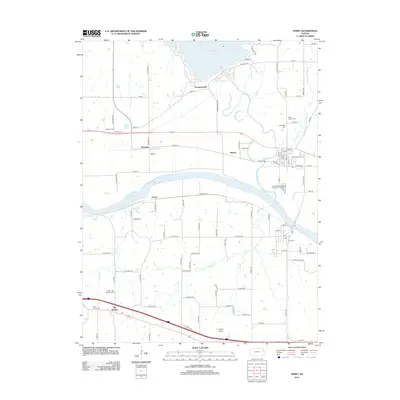
2012 Map of Perry
USGS Topo · Published 2012About this map
Big Springs anchors the southwest corner of this landscape, situated along a transportation corridor that cuts through the fertile valley of the Kansas River. This 2012 survey illustrates a region defined by its water management and agricultural layout, where the Delaware River feeds into the expansive Perry Lake behind a significant dam structure accessed by Dam Rd. Small settlements like Newman, Medina, and Thompsonville dot the northern half of the quadrangle, connected by a network of rural roads such as Old 24 Rd and Bridge Rd.
Find a feature on this map
86 named features on this map. Tap any name to fly to it.
Don’t see what you’re looking for? This feature index may not catch every label — zoom into the map to look around manually.
Map Details
Editions of this 2012 Perry Map
This is the sole edition of this map. No revisions or reprints were ever made.
Other maps of this area

1885 · Lawrence
USGS Topo · 1:125,000

1886 · Oskaloosa
USGS Topo · 1:125,000

1888 · Oskaloosa
USGS Topo · 1:125,000

1889 · Burlingame
USGS Topo · 1:125,000

1889 · Topeka
USGS Topo · 1:125,000

1889 · Lawrence
USGS Topo · 1:125,000

1894 · Burlingame
USGS Topo · 1:125,000

1894 · Oskaloosa
USGS Topo · 1:125,000

1894 · Topeka
USGS Topo · 1:125,000

1947 · Lawrence
USGS Topo · 1:250,000