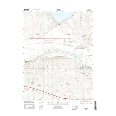
2016 Map of Perry
USGS Topo · Published 2016About this map
The Kansas River serves as a central corridor for this 2016 survey, with the Delaware River feeding into it from the north. The landscape is defined by the massive infrastructure of Perry Lake, where the Dam Rd and Spillway Rd mark the southern boundary of the reservoir. Settlements such as Perry, Lecompton, and Big Springs are established points of interest, while smaller locales like Thompsonville, Newman, Medina, and Grover dot the rural areas between the water and the rising terrain of Round Mound.
Find a feature on this map
53 named features on this map. Tap any name to fly to it.
Don’t see what you’re looking for? This feature index may not catch every label — zoom into the map to look around manually.
Map Details
Editions of this 2016 Perry Map
This is the sole edition of this map. No revisions or reprints were ever made.
Other maps of this area

1885 · Lawrence
USGS Topo · 1:125,000

1886 · Oskaloosa
USGS Topo · 1:125,000

1888 · Oskaloosa
USGS Topo · 1:125,000

1889 · Burlingame
USGS Topo · 1:125,000

1889 · Topeka
USGS Topo · 1:125,000

1889 · Lawrence
USGS Topo · 1:125,000

1894 · Burlingame
USGS Topo · 1:125,000

1894 · Oskaloosa
USGS Topo · 1:125,000

1894 · Topeka
USGS Topo · 1:125,000

1947 · Lawrence
USGS Topo · 1:250,000