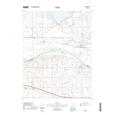
2018 Map of Perry
USGS Topo · Published 2018About this map
Perry Lake dominates the northern reaches of this landscape, its waters contained by a dam near Thompsonville and the Delaware River outlet. To the south, the Kansas River carves a broad valley through the border of Jefferson and Douglas Counties, supporting a string of communities along the Kansas Capitol Trl. The map details the historic settlement patterns of this river corridor, from the established town of Lecompton to smaller locales like Newman, Grover, and Medina. Genealogists will find a high density of burial sites across the township, including Maple Grove - Lecompton Cem and Mount Calvary Cem. The southern edge is defined by the community of Big Springs and the path of Old Hwy 40, illustrating the layering of modern infrastructure over older transport routes like the Kansas Capitol Trl.
Find a feature on this map
62 named features on this map. Tap any name to fly to it.
Don’t see what you’re looking for? This feature index may not catch every label — zoom into the map to look around manually.
Map Details
Editions of this 2018 Perry Map
This is the sole edition of this map. No revisions or reprints were ever made.
Other maps of this area

1885 · Lawrence
USGS Topo · 1:125,000

1886 · Oskaloosa
USGS Topo · 1:125,000

1888 · Oskaloosa
USGS Topo · 1:125,000

1889 · Burlingame
USGS Topo · 1:125,000

1889 · Topeka
USGS Topo · 1:125,000

1889 · Lawrence
USGS Topo · 1:125,000

1894 · Burlingame
USGS Topo · 1:125,000

1894 · Oskaloosa
USGS Topo · 1:125,000

1894 · Topeka
USGS Topo · 1:125,000

1947 · Lawrence
USGS Topo · 1:250,000